
Topographic & Land Survey Support
Photogrammetry and LiDAR can support orthomosaics, point clouds, terrain models, contours and site surfaces when the project coordinate system, corrections, control and checkpoints are properly established.
Drones can support topographic mapping, construction surveys, corridor work, earthworks, stockpile measurement, land-use documentation, urban modelling, environmental mapping and GIS updates. The useful outcome is not simply an aerial image, it is a controlled orthomosaic, point cloud, surface, model or measurement connected to the correct coordinate system and decision.
This guide explains where RGB photogrammetry, LiDAR, RTK and PPK positioning, control points, checkpoints, oblique imagery, fixed-wing VTOL platforms and processing software fit within professional geospatial workflows. It also addresses terrain, scale, accuracy, coordinate systems, quality assurance, computing and Canadian operating requirements.

Important: The aircraft is one part of a complete geospatial workflow that also includes positioning, control, coordinate systems, processing, quality assurance, professional review and compliant operations.
Select a topic below to move directly to that part of the surveying, mapping and geospatial consultation guide.
Drones are most effective when they shorten field time, improve coverage or make repeat collection practical without weakening the coordinate, validation or professional requirements of the project.
Photogrammetry and LiDAR can support orthomosaics, point clouds, terrain models, contours and site surfaces when the project coordinate system, corrections, control and checkpoints are properly established.
Repeatable mapping can document excavation, fill, grading, stockpiles, as-built conditions and progress. Comparable surfaces require consistent collection, boundaries and processing.
Long routes can be mapped for terrain, drainage, access, vegetation, right-of-way conditions and infrastructure context using corridor flight planning and suitable positioning.
Nadir and oblique imagery can produce textured 3D models of buildings, campuses and developed areas for planning, visualization, asset context and change documentation.
Current imagery and elevation data can support basemap updates, land-cover review, environmental studies, drainage analysis, restoration work and geospatial inventories.
Higher-endurance multicopters and fixed-wing VTOL systems can reduce the number of flights required across large or remote areas where access, terrain and daily coverage are major constraints.
A defensible result begins with the coordinate framework, deliverable and accuracy standard. Flight planning, field control, processing and validation should be designed as one workflow.
Confirm the deliverable, project area, coordinate system, accuracy, resolution, feature detail and reporting deadline.
Select the sensor, aircraft, RTK or PPK source, ground control, checkpoints, altitude, overlap and terrain strategy.
Fly under suitable wind, lighting and GNSS conditions, complete field checks and review coverage before demobilizing.
Generate the required outputs, apply coordinate and geoid settings, check independent points and document accuracy and limitations.
Important: RTK, PPK or a high-resolution camera does not automatically make a deliverable survey-grade. Independent checkpoints, coordinate verification, quality reports and professional responsibility remain essential.
The useful output may be an orthomosaic, point cloud, terrain model or textured 3D reconstruction. Each should be selected and validated around a specific project requirement.

Every output should connect to the correct coordinate system, vertical reference and project-control framework.

Classified point clouds and image-based surfaces can support terrain, drainage, earthwork and change-analysis workflows.
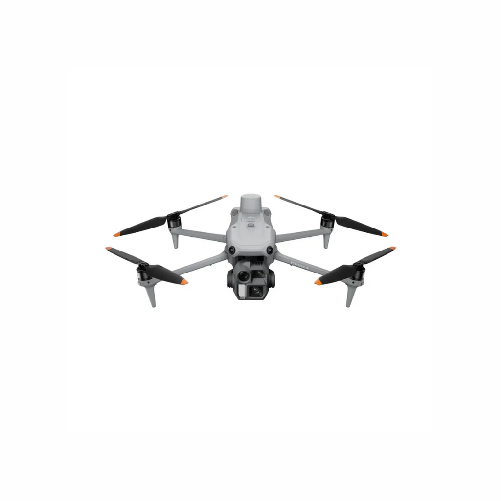
A mechanical-shutter, RTK-capable mapping platform can support rapid orthomosaic, surface and detailed 3D collection.
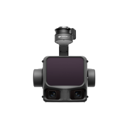
Long-range LiDAR and integrated RGB imaging can support efficient collection across complex terrain and broad project areas.
The correct sensor and platform depend on the deliverable, surface, terrain, scale, required accuracy, object detail, daily coverage and processing workflow.
| Project Question | Typical Deliverable | Common Technology Path | Key Planning Limits |
|---|---|---|---|
| Do we need a current high-resolution site map? | Orthomosaic, annotated basemap or GIS layer | Mechanical-shutter RGB camera with RTK or PPK positioning | Lighting, overlap, motion blur, surface texture, control and coordinate settings affect the result. |
| Do we need terrain or ground information through vegetation? | Classified point cloud, DTM, contours or terrain surface | Aerial LiDAR with GNSS and IMU positioning | Ground returns depend on vegetation, scan geometry, point density, range and classification quality. |
| Do we need detailed buildings or vertical structures? | Textured mesh, oblique model, façade context or digital twin | Nadir and oblique photogrammetry with planned multi-angle capture | Occlusion, reflective surfaces, narrow spaces, lighting and image count can affect model completeness. |
| Do we need stockpile, cut-and-fill or progress quantities? | Surface comparison, volume report or progress model | Repeatable RGB photogrammetry or LiDAR with validated surfaces | Boundaries, hidden surfaces, base definition, coordinate consistency and processing create major differences. |
| Do we need to map a long corridor or very large area? | Corridor orthomosaic, terrain, LiDAR or linear-asset dataset | Higher-endurance multicopter or fixed-wing VTOL mapping system | Visual range, terrain, airspace, launch and recovery, wind, daily logistics and data volume determine feasibility. |
| Do we need legal boundaries or a certified survey deliverable? | Professional survey plan, boundary opinion or regulated deliverable | Drone data integrated under the direction of the appropriate licensed professional | Drone imagery cannot independently establish legal boundaries or replace jurisdiction-specific professional responsibility. |
These terms are connected, but they are not interchangeable. Understanding the role of each component helps prevent inaccurate expectations and mismatched equipment.
Uses overlapping photographs to create orthomosaics, point clouds, surfaces and textured models. Mechanical shutters, suitable overlap, stable exposure and surface texture improve results.
Measures ranges using laser returns and can capture terrain, vegetation, structures and corridors with strong geometric consistency. Positioning and classification still require validation.
Corrects aircraft or image positions using reference observations. RTK works during collection; PPK applies corrections afterward. Neither eliminates the need to define and validate the project framework.
Control points help constrain a model, while independent checkpoints test the result. Their quantity, placement, measurement method and coordinate quality matter more than simply having markers on site.
GSD describes the ground area represented by one image pixel. Smaller GSD provides finer image detail but increases flight time, image count, storage and processing demand.
Horizontal and vertical references determine where the dataset sits and how elevations are reported. A correct-looking model can still be wrong if the coordinate or geoid settings are mismatched.
Nadir imagery looks downward and is efficient for mapping surfaces. Oblique imagery adds side views that improve façades, structures, edges and complex 3D reconstruction.
DJI Terra, WingtraCLOUD and compatible third-party platforms can process imagery or LiDAR into project outputs. Hardware, licensing, quality reports, export formats and staff capacity should be planned together.
This official DJI Enterprise introduction shows how the Zenmuse P1 supports high-efficiency aerial photogrammetry, orthomosaic collection, oblique modelling and detailed 3D reconstruction. A professional deliverable still depends on control, coordinate settings, validation and project-specific quality requirements.
A useful consultation begins with the deliverable, coordinate framework, accuracy, project scale and operating environment—not a model number.
Survey and mapping projects combine aviation requirements with property access, road and public exposure, professional survey responsibilities, privacy, coordinate standards and data governance.
Build pilot authority, site access, coordinate verification, ground control, public-safety measures, data handling and escalation procedures before field collection. Re-flying a site because the framework was wrong is far more expensive than confirming it first.
Confirm whether the mission fits Basic, Advanced, Level 1 Complex or special-operation requirements. Aircraft weight, airspace, proximity to people, visual range and operating concept determine the required authority.
Review Transport Canada operation categoriesLong corridors and broad sites may exceed a practical visual-line-of-sight footprint. The concept of operations should address observers, communications, airspace, terrain masking, contingencies and the applicable approval pathway.
Review special-operation guidanceLegal boundaries, cadastral opinions and regulated survey products may require a licensed land surveyor or another qualified professional. Confirm the requirements of the province, territory and project before describing a drone output as a legal survey.
Confirm permission for launch, recovery, control points and site access. Plan how imagery, coordinates, buildings, people, vehicles and client data will be stored, shared and retained.
Important: Aviation, professional, property, privacy and data requirements change over time and should not be treated as legal or surveying advice. Confirm current federal, provincial, territorial, municipal, professional-body, land-owner and project-specific requirements for each operation.
A pilot project should test the complete workflow—from control and flight planning to processing, accuracy validation, export and use by the project team.
Set the deliverable, coordinate system, accuracy, coverage, turnaround and decision owner.
Collect a representative project with realistic terrain, surface, access and correction conditions.
Compare the outputs against independent checkpoints, known features and the project accuracy standard.
Create repeatable control, flight, naming, processing, QA, export and storage procedures.
Expand platforms, crews or project areas after daily coverage, computing and quality are proven.
These are neutral starting points for consultation. The correct system depends on project scale, terrain, required detail, sensor type, control, daily coverage, processing and professional workflow.
Platform Note: The fastest aircraft or highest-resolution sensor is not automatically the best mapping system. Flight geometry, coordinate control, checkpoints, processing and the team’s ability to validate and deliver the data matter more than a single headline specification.
For rapid topographic, construction, earthwork and detailed 3D mapping from a compact single-pilot field kit with mechanical-shutter and RTK capability.
For large, complex or steep projects requiring long-range LiDAR, high-resolution RGB mapping and enterprise-scale daily coverage.

For organizations using modular LiDAR or full-frame photogrammetry payloads with hot-swappable batteries and an established enterprise workflow.
| System Path | Typical Role | Strengths | Planning Notes |
|---|---|---|---|
| DJI Matrice 4E | Portable photogrammetry, construction, earthworks, stockpiles and detailed 3D capture | Compact deployment, 20 MP mechanical-shutter mapping camera, RTK capability and fast automated routes | Confirm GSD, overlap, oblique requirements, correction source, checkpoints and software against the project standard. |
| DJI Matrice 400 + Zenmuse L3 | Large-area LiDAR, corridors, complex terrain and high-efficiency RGB or 3D data collection | Long-range LiDAR, dual 100 MP RGB mapping cameras and enterprise platform endurance | Requires larger field logistics, positioning control, processing capacity, trained crews and a clear accuracy framework. |
| DJI Matrice 350 RTK + Zenmuse L2 or P1 | Existing modular survey fleets, LiDAR, full-frame photogrammetry and repeat enterprise work | Field-proven platform, hot-swappable batteries and interchangeable geospatial payloads | Compare sensor generation, daily coverage, lifecycle, firmware, processing and support against newer pathways. |
| WingtraRAY + Mapping Sensor | Large-area photogrammetry, corridor, cadastre, mining, construction and geospatial programs | VTOL deployment, fixed-wing efficiency, high-resolution mapping sensors and integrated PPK workflow | Confirm sensor, Canadian operating category, project airspace, wind, launch area, processing path and support package. |
| D-RTK 3, Control & Checkpoints | Base or rover positioning, local corrections, control measurement and accuracy validation | Connects aircraft data to a repeatable coordinate and QA workflow | Known coordinates, antenna setup, logging, observation duration, corrections and independent checks must be documented. |
| DJI Terra, WingtraCLOUD & Third-Party Software | Photogrammetry, LiDAR processing, quality reporting, model editing and CAD/GIS export | Converts field data into maps, point clouds, surfaces, meshes and project files | Plan licensing, hardware, storage, user roles, coordinate support, formats, QA and processing turnaround with the aircraft. |
Share the project area, terrain, required deliverable, coordinate system, accuracy, daily coverage and processing workflow. Unmanned Canada can help narrow the aircraft, sensor, positioning, software, training and support pathway before moving into a formal quote.
Common questions from surveyors, engineers, GIS teams, contractors, municipalities and geospatial organizations evaluating drone mapping systems.
Accuracy depends on the sensor, flight geometry, RTK or PPK corrections, control, checkpoints, coordinate framework, surface, processing and quality assurance. The system should be validated against the project’s actual horizontal and vertical requirements.
RTK can reduce the amount of control needed in suitable workflows, but it does not eliminate the need to verify the result. Independent checkpoints are still valuable for detecting offsets, vertical-reference problems and processing errors.
LiDAR is often preferred for vegetation, terrain, corridors, uniform surfaces or projects requiring direct range measurements and strong 3D geometry. Photogrammetry is highly effective for detailed colour imagery, orthomosaics, exposed surfaces and textured models.
Matrice 4E is the more portable choice for efficient RGB photogrammetry and single-pilot fieldwork. Matrice 400 with L3 is suited to larger, more complex LiDAR programs requiring greater range, endurance, coverage and processing capacity.
WingtraRAY is a fixed-wing VTOL pathway for organizations prioritizing large-area survey efficiency, high-resolution photogrammetry and an integrated PPK workflow. Suitability depends on the sensor, project airspace, wind, Canadian operating category and downstream software.
Drone imagery can support field evidence, mapping and site context, but legal boundaries and regulated cadastral products may require a licensed land surveyor and jurisdiction-specific procedures. Do not treat an orthomosaic edge as a legal boundary without professional confirmation.
Yes. A complete package can include the aircraft, payload, RTK or PPK equipment, control accessories, batteries, software, computing guidance, training, demonstrations, regulatory planning, workflow design and lifecycle support.
