
Transmission & Distribution Lines
Optical zoom, thermal and corridor-mapping systems can document conductors, insulators, hardware, structures, vegetation, access routes and right-of-way conditions from planned stand-off distances.
Drones can help utilities, energy producers, industrial operators and inspection teams observe assets from safer stand-off distances, collect repeatable visual and thermal records, map long corridors and reach locations that are slow or hazardous to inspect from the ground. The useful outcome is not simply an image—it is a trustworthy observation connected to the correct asset, operating condition and maintenance decision.
This guide explains where thermal imaging, optical zoom, LiDAR, photogrammetry, gas sensing, remote operations and fleet software fit within power-line, substation, solar, wind, pipeline and industrial-facility workflows. It also addresses clearance, energized equipment, environmental conditions, data security, qualified interpretation and Canadian operating requirements.

Important: The aircraft is one part of a complete inspection program that also includes asset identification, controlled collection conditions, qualified interpretation, maintenance integration and compliant operations.
Select a topic below to move directly to that part of the energy, utilities and inspections consultation guide.
Drones are most useful when they reduce exposure, improve inspection frequency or create a better record for maintenance and engineering teams. They should support—not replace—asset standards, electrical safety procedures, specialist testing and qualified professional judgement.
Optical zoom, thermal and corridor-mapping systems can document conductors, insulators, hardware, structures, vegetation, access routes and right-of-way conditions from planned stand-off distances.
Radiometric thermal and detailed visual imagery can support screening of connectors, bushings, transformers, switches and other components when electrical load, weather, angle and reflection conditions are documented.
Thermal and RGB collection can support module-anomaly screening, string-level investigation, vegetation review, site documentation and repeatable reporting when irradiance, timing, altitude and flight geometry are controlled.
High-resolution visual inspection can document blade surfaces, leading edges, lightning receptors, nacelles and towers while reducing selected rope-access, climbing and shutdown exposure.
Visual, thermal, LiDAR and compatible gas-sensing workflows can support tanks, piping, flare areas, corridors, roofs, structures and selected leak-screening or integrity programs.
Drone docks can support scheduled or event-driven missions over fixed assets. Reliable power, network coverage, weather planning, cyber security, maintenance and approved remote operations must be designed together.
A dependable inspection begins with the asset register, component and failure mode, then carries the observation through controlled collection, qualified review, prioritization and maintenance-system integration.
Identify the asset, component, expected defect, required evidence, inspection standard, operating state and maintenance decision.
Select the sensor, stand-off, angle, timing, route, aircraft, safety controls and data structure required to observe the condition.
Capture visual, thermal, LiDAR or gas data while recording weather, load, asset state, distance, angle and field observations.
Have qualified personnel classify findings, link them to the correct asset, prioritize follow-up and preserve the record for comparison and audit.
Important: A thermal hotspot, visual mark, point-cloud feature or gas indication is an information source—not a final diagnosis. Asset identity, operating conditions, severity criteria and follow-up testing determine the maintenance value.
The useful result may be a detailed component image, a radiometric thermal record, a corridor model or a repeatable remote inspection. Each requires different collection conditions, sensors, safety controls and review expertise.

Aerial imagery and mapping can document asset condition, access limitations, vegetation encroachment and right-of-way change across long corridors.

Controlled thermal and RGB collection can help teams screen large arrays and direct closer electrical or physical investigation.
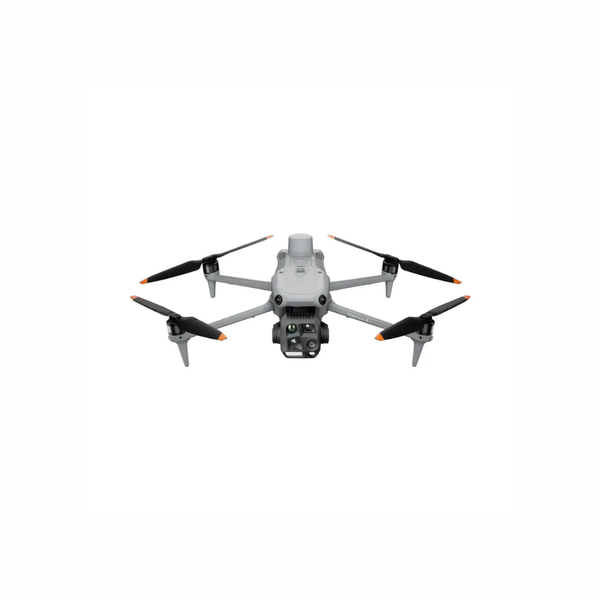
A compact integrated platform can support rapid inspection of distribution assets, substations, roofs, solar sites and industrial facilities.
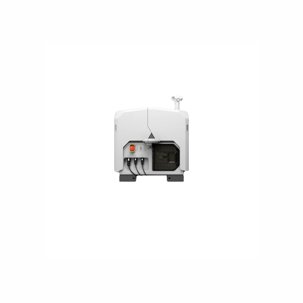
Dock-based systems can support repeatable inspection where site design, network, weather, airspace, staffing and maintenance are planned as one program.
The correct technology depends on the failure mode, object size, required evidence, stand-off, asset geometry, operating state, environmental conditions and downstream review process.
| Inspection Question | Typical Deliverable | Technology Path | Key Planning Limits |
|---|---|---|---|
| Are electrical components showing abnormal heat patterns? | Radiometric thermal images, temperature data and an asset-linked anomaly record | Thermal camera paired with visual context and repeatable asset identification | Load, emissivity, reflections, wind, distance and angle strongly affect apparent temperature. |
| Can small hardware, corrosion or surface damage be documented from stand-off? | Detailed optical imagery, annotated findings and repeatable viewpoints | High-resolution zoom camera with suitable stabilization and controlled stand-off | Atmospheric haze, vibration, motion blur, sun angle and digital zoom can reduce usable detail. |
| What are the corridor, clearance or vegetation conditions? | Point cloud, terrain model, structure geometry, clearance analysis or change layer | LiDAR, RGB mapping, RTK or PPK positioning and suitable processing software | Range, scan geometry, classification, coordinate control and vegetation state affect the result. |
| Which solar modules or strings require closer investigation? | Thermal anomaly map, visible context and module-level review record | Radiometric thermal and RGB collection with repeatable route planning | Irradiance, wind, temperature, load, flight direction and module reflections must be controlled. |
| Can a wind turbine or elevated structure be inspected without climbing? | Geotagged blade, nacelle, tower or structural imagery | Zoom imaging, planned oblique routes and selected 3D context | Wind, blade position, shutdown status, safe separation and object resolution determine feasibility. |
| Can routine monitoring begin from a remote site? | Scheduled imagery, remote live view, repeatable mission record or alert-driven task | DJI Dock 3, Matrice 4D or 4TD and FlightHub 2 or compatible software | Power, network, weather, site placement, airspace, remote staffing, BVLOS authority and contingency plans are essential. |
| Is specialized gas screening required? | Gas-specific indication, concentration pattern or inspection record | Compatible gas sensor or optical gas-imaging workflow integrated with a suitable aircraft | Target gas, sensor principle, calibration, airflow, stand-off, environmental conditions and specialist interpretation determine suitability. |
Each technology answers a different inspection question. Adding more sensors does not automatically improve the result unless the collection method, analysis and maintenance workflow are defined.
Measures apparent surface-temperature patterns and can support electrical, mechanical, solar and building-envelope screening. It does not see through equipment and requires controlled collection and qualified interpretation.
Helps operators document small components and surface condition while maintaining distance from energized or inaccessible assets. Atmosphere, stability and lighting determine usable resolution.
Creates point clouds for corridor geometry, conductor and vegetation clearances, terrain, structures and change analysis. Positioning, range, reflectivity, scan angle and classification still require validation.
Builds orthomosaics, meshes and surface models from overlapping imagery for sites, structures and progress documentation. The workflow must match the required resolution and accuracy.
Can help place observations on a map and connect images to poles, towers, components or work orders. The coordinate and asset association should be treated according to its measured confidence.
Different sensors target different gases and measurement principles. Compatibility, airflow, calibration, stand-off and the required detection or quantification objective should be confirmed before platform selection.
Supports repeatable remote missions, centralized oversight and task records. A dependable deployment requires site design, power, network, weather, maintenance, cyber security and an approved concept of operations.
Software can organize imagery, models, findings and repeat missions or assist with screening. Human review, asset naming, thresholds, user permissions and integration with GIS, EAM or work orders remain essential.
This official DJI Enterprise case study shows how the Matrice 4T supports solar-facility and utility-infrastructure inspection using thermal imaging, high-reach optical zoom and repeatable field workflows. A dependable program still requires asset standards, controlled conditions, safe stand-off and qualified maintenance review.
A useful consultation begins with the asset, failure mode, inspection standard, environment and required maintenance record—not a model number.
Energy and utility inspection combines aviation requirements with electrical and industrial safety, critical-infrastructure data controls, environmental obligations and professional inspection responsibilities.
Build pilot authority, asset coordination, electrical clearances, collection conditions, data handling and escalation procedures before the inspection window. A technically strong sensor cannot compensate for the wrong asset, unsafe stand-off or undocumented operating state.
Confirm whether the mission fits Basic, Advanced, Level 1 Complex or special-operation requirements. Aircraft weight, airspace, distance from people, corridor length and the operating concept determine the required certificate, declaration, operator certificate or permission.
Review Transport Canada operation categoriesLong corridors, remote sites and dock-based operations require an operating pathway that addresses communications, airspace, detect-and-avoid, staffing, contingencies and the approved concept of operations.
Review special-operation guidanceFollow the asset owner’s orientation, approach boundaries, grounding and switching rules, PPE, vehicle control, hazardous-area and emergency procedures. A drone changes access—it does not remove electrical or industrial hazards.
Define where imagery, thermal data, asset coordinates and live feeds are stored, who may access or export them and how findings are reviewed by personnel qualified for the asset and inspection method.
Important: Regulatory, electrical-safety, environmental and professional requirements change over time and should not be treated as legal or engineering advice. Confirm current federal, provincial, territorial, municipal, site-owner, utility, privacy, cyber-security and project-specific requirements for each operation.
A pilot project should test the complete chain—from mobilization and safe collection to defect visibility, qualified review, maintenance handoff and repeatability.
Select the asset, failure mode, inspection standard, decision owner and measurable success criteria.
Capture representative assets under realistic load, weather, stand-off and site conditions.
Compare aerial findings with known defects, existing inspection methods and qualified technical review.
Create routes, naming, thresholds, SOPs, data controls, maintenance checks and work-order handoff.
Expand assets, crews, sensors or remote sites after reliability, value, support and governance are proven.
These are neutral starting points for consultation. The correct configuration depends on asset type, failure mode, object resolution, stand-off, weather, corridor scale, remote-operation requirements and data workflow.
Platform Note: A high zoom ratio, thermal resolution or LiDAR range does not guarantee a useful inspection. Object size, distance, angle, atmosphere, asset state, flight stability, operator technique and qualified review determine the real result.
For rapid inspection of distribution assets, substations, solar arrays, roofs and industrial facilities from a compact single-pilot field kit.
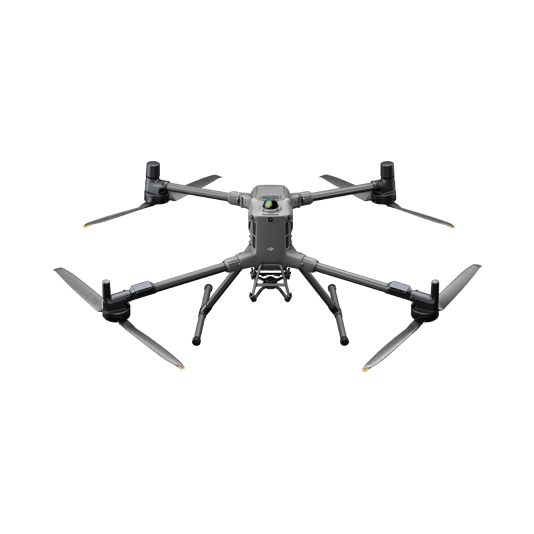
For demanding thermal, long-range zoom, low-light and multi-payload missions where endurance, reach and enterprise field support matter.
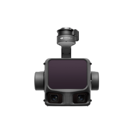
For LiDAR and RGB collection across utility corridors, terrain, vegetation, structures and clearance-analysis workflows.
For scheduled or event-driven fixed-site inspection where power, network, weather, BVLOS authority and remote contingencies are designed into the program.
| System Path | Typical Inspection Role | Strengths | Planning Notes |
|---|---|---|---|
| DJI Matrice 4T | Distribution, substations, solar, roofs and facility inspection | Portable integrated thermal, zoom, low-light and rangefinding workflow | Test object resolution, thermal conditions, weather, accessories and stand-off on the actual asset. |
| DJI Matrice 400 + Zenmuse H30T | Transmission, wind, industrial assets and advanced thermal or optical inspection | Higher-endurance multi-payload platform with high-reach visual and thermal sensing | Requires larger transport, battery infrastructure, trained crews, payload planning and lifecycle support. |
| DJI Matrice 400 + Zenmuse L3 | Corridor mapping, terrain, vegetation, structures and clearance analysis | Long-range LiDAR, high-resolution RGB mapping and enterprise platform endurance | Requires positioning control, processing capacity, classification expertise and a defined accuracy framework. |
| DJI Dock 3 + Matrice 4TD | Fixed-site inspection, recurring imagery and remote operational monitoring | Remote launch, charging, weather protection and centralized FlightHub 2 workflows | Requires reliable power and network, site placement, coverage analysis, operating authority and contingency procedures. |
| DJI Matrice 30T / Matrice 350 RTK Fleets | Existing utility and industrial inspection programs | Field-proven weather-resistant or modular enterprise workflows | Review batteries, support, firmware, sensor generation and lifecycle before expanding or transitioning the fleet. |
| FlightHub 2, DJI Terra & Lifecycle Support | Fleet oversight, remote operations, mapping, data processing and support | Connects aircraft activity to task records, models, collaboration and maintenance planning | Licensing, user roles, integrations, cyber security, data hosting, training and support should be planned with the aircraft. |
Share the asset type, failure mode, stand-off, operating condition, inspection frequency and required record. Unmanned Canada can help narrow the aircraft, sensor, software, training, compliance and lifecycle-support pathway before moving into a formal quote.
Common questions from utilities, energy producers, industrial operators, engineers and inspection teams evaluating drone technology.
Thermal imagery can reveal apparent temperature differences, but the cause and severity depend on load, emissivity, reflection, weather, angle, distance and asset condition. Qualified interpretation and follow-up testing are required.
Drones can support inspection from planned stand-off distances, but the program must follow the asset owner’s approach boundaries, electrical-safety procedures, switching and grounding requirements, crew roles and emergency controls. The aircraft does not remove electrical hazards.
Matrice 4T is the more portable option for rapid integrated thermal and zoom inspection. Matrice 400 with H30T is better suited to longer-duration, higher-reach, demanding-weather or multi-payload missions. The right choice depends on asset size, launch time, stand-off, transport, staffing and support requirements.
LiDAR is useful when the requirement involves corridor geometry, terrain, structures, conductor or vegetation clearances, 3D change analysis or areas where image-only reconstruction is insufficient. Accuracy and classification still require a defined positioning and validation workflow.
Compatible dock and aircraft systems can support scheduled or event-driven remote missions. A deployable program still requires reliable power and network, suitable site placement, weather planning, remote oversight, maintenance, airspace analysis, operating authority and contingency procedures.
Typical records include the asset and component ID, time, electrical or mechanical load, ambient conditions, wind, distance, angle, emissivity assumptions, reflected temperature settings, camera mode, image files, operator observations and the review or escalation outcome.
Yes. A complete engagement can include requirement discovery, aircraft and payload configuration, demonstrations, pilot deployment, training, compliance planning, software and data-workflow design, maintenance planning and phased scaling.
