
Perimeter & Large-Site Awareness
Observe fence lines, yards, access routes, storage areas and remote portions of industrial, utility, logistics or institutional sites.
SECURITY · SURVEILLANCE · COUNTER-UAS
Drones can support perimeter awareness, alarm verification, remote patrols, incident documentation and large-site monitoring. Counter-UAS programs address a different problem: detecting, assessing and lawfully responding to an unknown or unauthorized drone.

WHERE DRONES FIT
A security drone is most useful when it improves how an authorized team verifies an alert, understands a large site or documents an incident. It should support—not replace—guards, cameras, access control, emergency procedures and accountable human judgement.
Observe fence lines, yards, access routes, storage areas and remote portions of industrial, utility, logistics or institutional sites.
Send an authorized aerial system to provide visual or thermal context after an alarm, sensor event or report requires confirmation.
Use repeatable routes or pre-positioned dock systems to monitor defined areas, subject to operating authority and site controls.
Provide a controlled overhead view of access, traffic, crowd movement, hazards or changing conditions through approved command channels.
Use low-light, zoom and thermal sensors to screen for visible activity or heat patterns while accounting for sensor limitations.
Capture organized imagery, site context and repeatable records for authorized investigation, reporting, insurance or operational review.
Operational imagery is one information source. A drone view does not establish intent, identity or cause on its own. Observations should be confirmed through the organization’s approved security, privacy and incident procedures.
THREE DIFFERENT SECURITY LAYERS
Each layer has different equipment, evidence, authority, risk and procurement requirements.
Your organization operates an authorized drone to patrol, verify an alert, inspect a site or provide an approved live view.
A site uses compatible sensing and command tools to identify a possible drone event, assess available information and notify the proper authority.
Actions that interfere with, seize, redirect or physically affect an aircraft can engage serious legal, aviation, spectrum and safety restrictions.
SECURITY WORKFLOW
A useful system connects technology to a named decision-maker, approved response and traceable incident record.
Identify the site, protected activity, security question, decision owner and success criteria.
Receive an alert from approved cameras, sensors, reports, drone systems or counter-UAS awareness tools.
Assess available visual, thermal, location and contextual information without assuming identity or intent.
Apply the organization’s authority, escalation, privacy, airspace and incident-command procedures.
Take the approved action, preserve required records and review how the information affected the outcome.
VISUAL REFERENCE
Portable aircraft, advanced payload platforms and docked systems solve different security and surveillance problems.
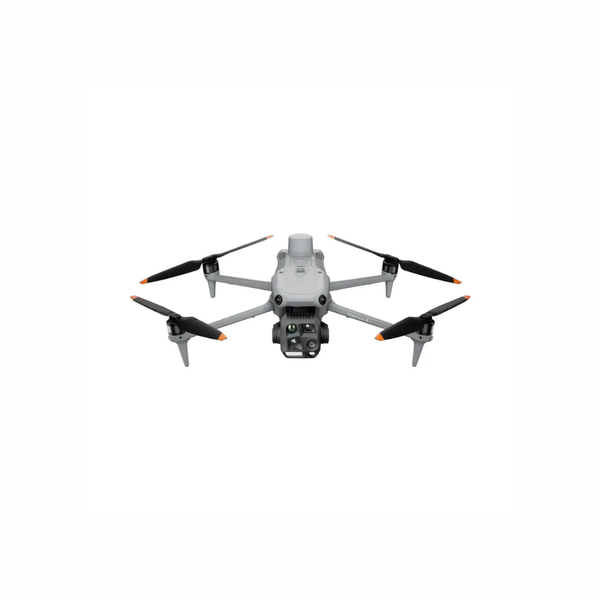
A compact aircraft can support mobile patrol, alarm verification and short-notice site observation.
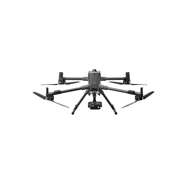
A larger platform can support advanced thermal, optical, lighting, communication and specialized integrations.
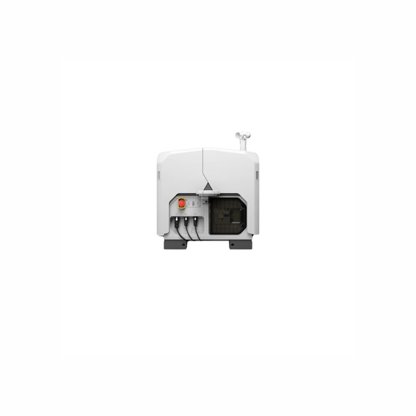
A dock can support repeat patrols and alert-driven deployment when power, network, coverage and operating authority are in place.
Different sensors may be correlated to improve awareness, but performance and legal fit must be validated for the actual site.
DECISION GUIDE
This table is a consultation starting point. The final system depends on the site, operating authority, environment, required evidence and approved response.
| Operational Question | Typical Output | Technology Path | Key Planning Limits |
|---|---|---|---|
| What is happening at a remote part of the site? | Live visual or thermal view, location and incident record | Portable thermal/zoom drone or approved dock workflow | Airspace, weather, link coverage, pilot workload, privacy and response authority |
| Can routine patrols cover a large fixed site? | Repeat route, exception imagery and date-based records | Dock, route planning, fleet software and remote operations | Power, network, BVLOS pathway, obstructions, weather and human supervision |
| Is a possible drone near the protected site? | Alert, track, classification confidence and supporting sensor record | Radar, RF and/or optical-thermal detection architecture | False alarms, clutter, line of sight, spectrum rules, coverage and sensor limitations |
| Who should receive and assess a drone alert? | Verified incident notification and escalation record | Command software, security operations integration and SOPs | User roles, training, retention, cybersecurity and 24/7 response ownership |
| Can the organization stop or take control of the drone? | Authority-specific legal and operational determination | Legal review and authorized-agency coordination | Detection alone does not authorize interference, jamming, seizure or physical action |
| What changed after an incident? | Organized imagery, map, timeline or site-condition record | RGB mapping, zoom imagery, thermal and incident data management | Evidence handling, accuracy, access, privacy and professional interpretation requirements |
TECHNOLOGY EXPLAINED
Combining technologies can improve context, but only when each sensor’s role, coverage and limitations are defined.
Supports stand-off observation and visual verification. Darkness, weather, atmosphere, vibration, angle and digital zoom affect usable detail.
Shows apparent surface-temperature patterns. Thermal cameras do not see through walls, and distance, glass, water, emissivity and weather affect interpretation.
May detect and track small aerial objects without relying on a cooperative radio signal. Site clutter, terrain and target characteristics affect performance.
May identify compatible command or transmission activity. It may not detect every aircraft, autonomous route or non-emitting target.
Cameras can help visually assess a detected track, but identification confidence depends on range, lighting, weather, lens reach and operator judgement.
Connects sensors, live video, maps, user roles, incident records and escalation procedures so information reaches an accountable decision-maker.
Provide pre-positioned aircraft, charging and remote tasking for suitable sites. Automation still requires oversight, authority and contingency planning.
Defines recording, access, export, retention, audit, hosting and disclosure controls for security imagery and counter-UAS event data.
CANADIAN CONSIDERATIONS
Security urgency does not remove aviation, spectrum, privacy, property, evidence or organizational obligations.
Confirm the aircraft, airspace, proximity, range, pilot certificate, registration and operator requirements for each surveillance or dock mission.
Docked or beyond-visual-line-of-sight operations require a compliant pathway, trained personnel and an approved concept of operations.
Innovation, Science and Economic Development Canada states that radio jammers are prohibited in Canada except for narrow authorized circumstances.
Define when monitoring is permitted, what areas are excluded, who may view footage, how long it is retained and how individuals are notified where required.
Document how detections are verified, preserved and transferred, and when security teams notify law enforcement, aviation authorities or site leadership.
Review user access, network architecture, encryption, cloud or on-premises requirements, system updates, audit logs and third-party integrations.
This page discusses security planning and counter-UAS awareness. It does not authorize jamming, signal interference, aircraft takeover, physical interdiction or other mitigation activity. Confirm the current law and the organization’s specific authority before procurement or deployment.
IMPLEMENTATION
A pilot should test the alert, sensor, operator, command, evidence and response workflow—not only whether the aircraft can fly.
Document the protected site, security question, authority, stakeholders, constraints and measurable outcome.
Build the sensor, aircraft, communications, data, staffing, compliance and incident-response architecture.
Test representative alerts and operating conditions through controlled exercises with documented limitations.
Create SOPs, training, maintenance, data controls, escalation rules, reporting and recurrent review.
Expand sites, sensors, docks or response coverage only after performance, authority and support are proven.
SYSTEM PATHWAYS
These are neutral consultation starting points. Specialized counter-UAS detection systems are evaluated separately from the aircraft used for authorized surveillance.
For mobile patrol, alarm verification, thermal awareness, zoom observation and rapid deployment from a compact field kit.
Explore Matrice 4 Series →
For longer-duration, longer-reach and multi-payload security operations requiring advanced thermal, zoom or accessory integration.
Explore Matrice 400 →
For fixed-site or vehicle-supported remote patrol, repeat routes and alert-driven awareness through a planned dock deployment.
Explore DJI Dock 3 →For sites requiring layered detection, track assessment, alert management, evidence handling and authority-based escalation.
Discuss Counter-UAS Requirements →| System Path | Typical Security Role | Primary Strength | Planning Notes |
|---|---|---|---|
| DJI Matrice 4T | Mobile patrol, alarm verification and rapid thermal/zoom observation | Compact deployment and integrated multi-sensor payload | Confirm weather, lighting, battery rotation, privacy and pilot operating requirements |
| DJI Matrice 400 + H30T | Advanced site overwatch and longer-reach multi-payload operations | Endurance, sensor reach and payload flexibility | Requires larger logistics, trained crews, payload configuration and lifecycle planning |
| DJI Dock 3 + Matrice 4TD | Repeat patrol and remote alert verification | Pre-positioned aircraft, charging and centralized tasking | Requires coverage study, power, network, BVLOS pathway, remote staffing and contingencies |
| FlightHub 2 or Compatible Software | Fleet, live video, task, user and remote-site coordination | Centralized operational awareness and records | Review licensing, integrations, cybersecurity, hosting, permissions and retention |
| Counter-UAS Detection System | Awareness of possible unauthorized drone activity | Layered sensing and alert correlation | Validate site performance, false alarms, coverage, lawful use and escalation; mitigation is separate |
FREQUENTLY ASKED QUESTIONS
Common questions from organizations evaluating aerial surveillance, remote security operations and counter-UAS awareness.
A security drone is an aircraft your organization operates for an authorized patrol, inspection or incident view. A counter-UAS system is designed to detect, track, assess or support response to another drone. They require different technology, authority and procedures.
Compatible docks can support scheduled routes and remote tasking, but the operating model still depends on site design, weather, communications, supervision, airspace and the Canadian approval pathway. Automation does not remove operator accountability.
Radio jammers are prohibited in Canada except for narrow authorized circumstances. A commercial detection system does not automatically provide legal authority to interfere with an aircraft or radio signal. Obtain specific legal and regulatory guidance.
Thermal cameras display apparent surface-temperature patterns; they do not see through walls. Identification and interpretation are affected by range, angle, weather, materials, glass, water and the scene context.
Potential environments include utilities, industrial plants, logistics yards, construction sites, campuses, remote infrastructure and other large properties. Feasibility depends on airspace, surrounding people, privacy, site hazards and the approved security objective.
A planning engagement can address mission discovery, aircraft and sensor configuration, demonstrations, dock feasibility, software, training, compliance, maintenance and phased implementation. Counter-UAS products and partners must be confirmed against the specific requirement and lawful authority.
BUILD THE RIGHT SECURITY PROGRAM
Share the location, protected activity, site size, current security systems, response workflow and whether the requirement involves authorized surveillance, counter-UAS awareness or both.
