
Visual Crop Scouting
Collect high-resolution RGB imagery to review emergence, lodging, ponding, wheel tracks, storm damage, wildlife pressure, weed patches and other visible patterns across a field before directing ground scouts to priority areas.
Agricultural drones can help growers, agronomists, crop consultants, researchers and service providers observe fields, document variability, create maps and complete certain application tasks. The technology is most useful when it supports a specific management decision rather than producing imagery with no clear next step.
This guide separates the main agricultural workflows—visual scouting, multispectral analysis, mapping, stand assessment, spraying and spreading—so teams can understand what each approach can deliver, what it cannot determine on its own and which system characteristics matter before procurement.

Important: The aircraft is one part of a complete workflow that includes agronomy, calibration, processing, field verification and compliant operations.
Select a topic below to move directly to that part of the agriculture consultation guide.
A drone should improve how a farm or agronomy team finds, documents or responds to field conditions. Different missions require different cameras, aircraft, software and operational planning.
Collect high-resolution RGB imagery to review emergence, lodging, ponding, wheel tracks, storm damage, wildlife pressure, weed patches and other visible patterns across a field before directing ground scouts to priority areas.
Measure reflected light in visible and near-infrared bands to map relative crop variability. This can help identify zones that warrant closer inspection, compare treatments and monitor change through the season.
Use detailed aerial imagery and compatible analysis tools to estimate plant populations, identify gaps and compare establishment between fields, hybrids, varieties or management zones.
Create orthomosaics, elevation models and surface records to support drainage assessment, erosion monitoring, field planning, tile investigations, boundary documentation and seasonal comparison.
Use an agricultural application drone where the crop, product label, operating approval and provincial or territorial requirements permit. Potential uses include targeted treatment, hard-to-access areas and fields where ground traffic is undesirable.
Apply compatible granular materials, seed or fertilizer in supported workflows. Material size, density, rate, field conditions and calibration all influence whether a spreading system is appropriate.
The strongest case is usually tied to timing, access, repeatability or better prioritization—not simply replacing every ground-based task with a drone.
Potential Benefit: Screen the entire field from above, then direct scouts to unusual zones instead of relying only on roadside or transect observations.
Potential Benefit: Collect imagery without adding wheel traffic or waiting for machinery access, subject to safe flying conditions and the limits of the selected sensor.
Potential Benefit: Repeat flight plans and processing methods so crop development, drainage patterns, treatment response or storm damage can be reviewed consistently.
Potential Benefit: Use mapped variability and ground confirmation to define priority areas, support prescription planning or evaluate whether targeted application is practical and permitted.
Useful agricultural drone work continues after the flight. The capture, processing, interpretation and field-verification steps should be planned together.
Clarify whether the team is assessing emergence, crop stress, drainage, damage, treatment response, boundaries or an application task.
Select the correct sensor, timing, altitude, overlap, lighting conditions, calibration method and positioning workflow.
Create the required map or index, check data quality and compare zones, dates, fields or treatment areas using a consistent method.
Verify the pattern in the field, combine it with agronomic information and decide whether scouting, sampling, drainage work or treatment is justified.
Important: Drone imagery can show that two parts of a field are behaving differently. It does not automatically explain whether the cause is nutrient availability, disease, insects, moisture, compaction, soil variability, crop stage or another factor.
The useful result may be a current field image, a crop-variability layer, a high-resolution map or a documented application mission. Each output requires a different aircraft, sensor and operational plan.

Current aerial imagery can reveal spatial patterns, document field conditions and direct ground scouts toward priority areas.

Aerial records can help teams compare access conditions, field operations and changes that occur during narrow seasonal windows.
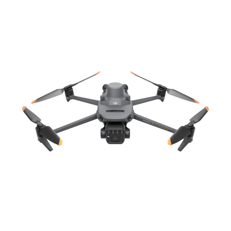
Purpose-built multispectral collection can highlight relative differences that warrant field inspection, comparison or treatment review.
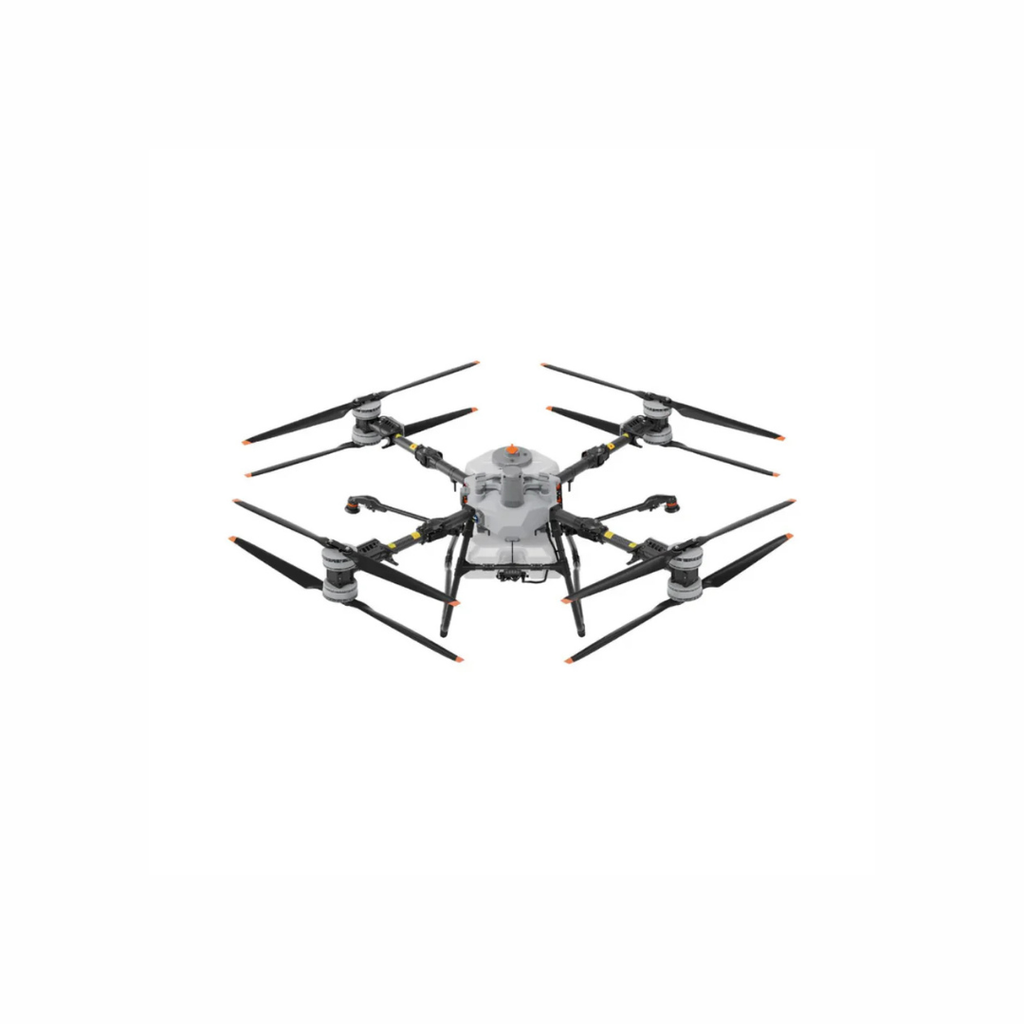
Application platforms require a complete plan for rate, calibration, refill logistics, batteries, cleaning, records and regulatory compliance.
This table helps separate workflows that may look similar from a distance but require different equipment and deliverables.
| Operational Need | Capabilities to Consider | Typical Output | System Direction |
|---|---|---|---|
| General crop scouting | Portable aircraft, high-resolution RGB camera, simple route planning and fast field setup | Overview imagery, field observations, annotated areas and visual records | Compact enterprise mapping or inspection drone |
| Crop variability and vegetation analysis | Multispectral bands, irradiance sensor, calibration workflow, RTK positioning and analysis software | NDVI or other vegetation-index maps, zone comparison and change monitoring | Purpose-built multispectral aircraft such as DJI Mavic 3M |
| Stand count and emergence | High ground resolution, consistent lighting, accurate georeferencing and compatible plant-count software | Plant population estimates, gap maps and establishment comparison | Mechanical-shutter mapping aircraft or a multispectral system, depending on crop and analysis method |
| Drainage and surface assessment | Photogrammetry, RTK or control points, repeatable mapping and terrain-model processing | Orthomosaic, surface model, contours, elevation change and drainage observations | RTK-capable mapping platform with suitable processing software |
| Spraying | Application tank, pump/nozzle system, route planning, terrain following, calibration, wash-down process and compliant operating plan | Application record, coverage log and treated-area documentation | DJI AGRAS platform sized to field, rate, crop and logistics |
| Spreading | Material compatibility, hopper capacity, feeder selection, calibration, desired rate and field logistics | Spread-area record, material-rate log and task documentation | DJI AGRAS platform with compatible spreading system |
These terms are often grouped together in marketing, but each serves a different purpose and produces a different type of information.
Useful for visual scouting, emergence review, lodging, drainage patterns, storm damage, mapping and documentation. RGB shows what is visible to the eye but at much greater scale and detail.
Captures selected bands such as green, red, red-edge and near-infrared. These bands can be combined into vegetation indices that highlight relative differences in canopy condition.
NDVI and related indices can help segment a field into relative zones. Results depend on crop stage, canopy cover, lighting, calibration, soil background and processing method.
RTK can support repeatable mapping and more accurately positioned datasets. It does not eliminate the need to define the required accuracy or validate the workflow for the intended deliverable.
Used to create orthomosaics, surface models, contours and 3D representations. Image overlap, motion blur, surface texture, control and processing settings affect the result.
May support irrigation research, livestock search, equipment inspection or specialized crop studies. Temperature patterns require careful timing and interpretation because sunlight, wind, moisture and surface type affect readings.
AGRAS systems carry liquid or granular material and follow planned routes. Successful use depends on rate, droplet or material characteristics, calibration, weather, refill logistics, battery turnaround, cleaning and regulatory compliance.
Tools such as DJI SmartFarm can help manage fields, equipment and operation records. Mapping and analysis may also involve DJI Terra or specialized agronomy platforms depending on the deliverable.
This DJI introduction shows how RGB and multispectral cameras are combined in a compact agriculture-mapping platform. A useful program still depends on correct timing, calibration, processing, agronomic interpretation and ground verification.
Clear expectations prevent teams from purchasing a sensor for a result it cannot provide on its own.
It can show where canopy response, emergence, moisture expression or visible damage differs across the field.
A low-index zone is not automatically a nutrient deficiency or disease diagnosis. Soil, moisture, pests, growth stage and field history must be considered.
Consistent capture dates, settings and processing make it easier to compare how a field changes after weather, treatment or crop development.
Some teams need a detailed prescription layer. Others only need an annotated map showing where to scout. Define the decision before paying for unnecessary complexity.
These questions help determine whether the farm needs a sensing platform, an application platform, a service provider or a combination of systems.
A pilot may be qualified to operate the aircraft without automatically being authorized to apply a particular product. Agricultural application programs must consider aviation rules, pesticide-label directions and provincial or territorial requirements together.
Under Science Policy Note SPN2026-02, an RPAS may be used for a registered pest-control product that is already approved for conventional aerial application, provided all label directions and applicable requirements are followed. A product that is not registered for aerial application still requires an approved label amendment. If the label says not to apply by air—or does not permit aerial application—RPAS application is prohibited.
The pilot certificate, aircraft registration, safety assurance and operating approval depend on what is being flown, how it is being flown and where the operation occurs. Larger application aircraft may involve more complex requirements than a compact scouting drone.
Review Transport Canada drone guidanceThe approved product label remains a legal use document. Application rate, buffer zones, weather restrictions, PPE, handling and other directions must be reviewed for the specific product and crop.
Review Health Canada SPN2026-02Licensing, certification, training, permits and commercial-application rules vary by jurisdiction. Confirm requirements with the relevant provincial or territorial authority before operating.
Build procedures for calibration, mixing, loading, application records, cleaning, drift management, incident response, equipment maintenance and secure storage of products and data.
Important: Regulatory information changes. Before an application mission, verify the current Transport Canada requirements, the Health Canada PMRA product label and the applicable provincial or territorial rules. This page is a planning resource, not legal, agronomic or pesticide-use advice.
Agriculture is seasonal, so a short test during the relevant crop stage is usually more informative than a generic demonstration outside the intended workflow.
Define crops, acreage, field distribution, decision points, deliverables, operating environment and current agronomy workflow.
Capture a real field at the correct crop stage and review whether the imagery or application workflow answers the intended question.
Use the system on a defined set of fields, document labour and turnaround time, and evaluate the usefulness of the deliverables.
Finalize equipment, software, batteries, power, transport, calibration, SOPs, training, maintenance and compliance responsibilities.
Expand only after confirming seasonal utilization, agronomic value, field logistics, support requirements and measurable workflow improvement.
The examples below are reference points, not preset packages. Product availability, Canadian configurations, supported accessories and firmware can change. Confirm the current system before procurement.
Platform Note: Sensing and application are different workflows. A mapping aircraft should be selected around image quality, repeatability and the required deliverable, while an AGRAS platform should be sized around application rate, field logistics, transport, power and compliant operation.
For crop variability mapping, vegetation-index workflows, field scouting, treatment comparison and repeatable seasonal monitoring.
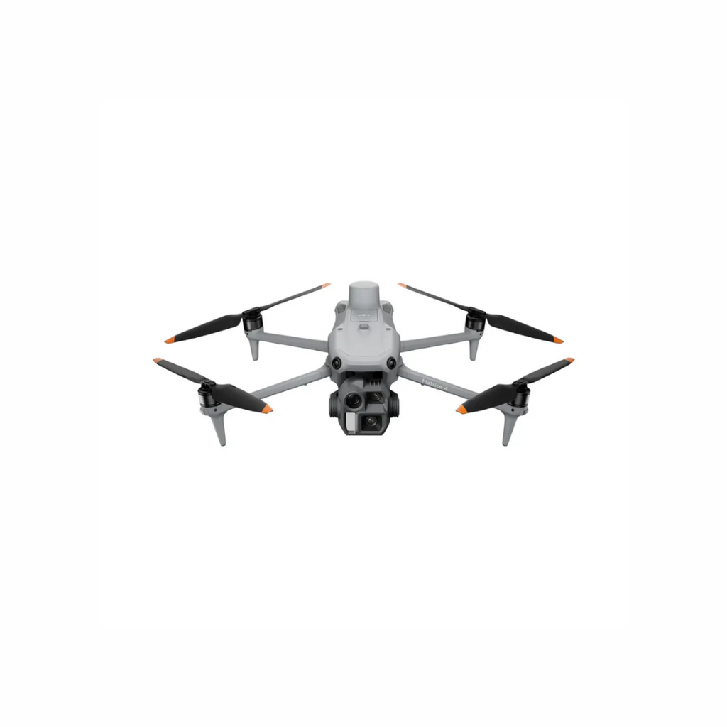
For detailed field mapping, stand assessment, drainage review, surface modelling and third-party analysis workflows requiring high-resolution RGB data.
For high-capacity spraying, spreading and selected lifting workflows where transport, crew, charging, refill logistics and operating authority are fully planned.
| System Type | Examples to Evaluate | Typical Strength | Important Questions |
|---|---|---|---|
| Multispectral scouting and mapping | DJI Mavic 3 Multispectral | Combines a 20 MP RGB camera with four 5 MP multispectral cameras covering green, red, red-edge and near-infrared bands | Required indices, crop stage, calibration method, processing software, RTK source, acreage and interpretation workflow |
| High-resolution RGB mapping and stand analysis | DJI Matrice 4E or another current mechanical-shutter enterprise mapping aircraft | Efficient RGB mapping, detailed field imagery and compatibility with third-party stand-count or mapping workflows | Ground resolution, acreage, plant size, desired count accuracy, software and validation method |
| Compact application platform | DJI AGRAS T25P | Portable solo-operation format with up to 20 kg spraying and 25 kg spreading capacity | Field size, application rate, refill logistics, transport, terrain, crop, material and local availability |
| Mid-size application platform | DJI AGRAS T50 | Up to 40 kg spraying or 50 kg spreading capacity for larger field operations | Daily acreage, water and loading logistics, battery turnaround, generator planning, nozzles, calibration and crew model |
| High-capacity application platform | DJI AGRAS T100 | Flagship platform with a maximum 100 kg payload and spraying, spreading and lifting configurations | Operating approval, transport, crew, site access, power infrastructure, application rate, support and return on utilization |
| Agriculture operations and data management | DJI SmartFarm, DJI Terra and compatible agronomy platforms | Field management, operation records, mapping, reconstruction and connection to broader analysis workflows | Required outputs, data ownership, integrations, subscription model, internet access and staff capability |
Share the crop, acreage, field conditions, seasonal timing, intended deliverable and whether the need is sensing or application. Unmanned Canada can help narrow the aircraft, sensor, software, battery, power and support options before moving into a formal quote.
These answers address common questions from farms, agronomists and agricultural service providers evaluating drone technology.
The best system depends on the job. DJI Mavic 3 Multispectral is designed for crop imaging and multispectral analysis. A mechanical-shutter mapping drone may be better for detailed RGB mapping or stand-count workflows. DJI AGRAS aircraft are application platforms for spraying or spreading rather than direct replacements for a dedicated multispectral scouting drone.
Not by itself. Multispectral data can identify relative crop differences and guide scouting, but similar patterns can be caused by many factors. Ground inspection, sampling, agronomic expertise and field history are needed to determine the likely cause.
RGB imagery records visible colour and is useful for detailed visual maps, emergence, damage and documentation. Multispectral sensors also capture selected non-visible bands, allowing vegetation indices and relative canopy analysis. The better choice depends on the decision being made.
Potentially, but the operation must satisfy aviation, pesticide-label and provincial or territorial requirements. As of June 30, 2026, Health Canada policy permits RPAS use for products already registered for conventional aerial application, provided all applicable directions are followed. Products that do not permit aerial application cannot be applied by RPAS without an approved label amendment.
Hiring a service provider may make sense for occasional mapping, specialized analysis or limited seasonal use. Ownership becomes more attractive when the farm has frequent time-sensitive missions, trained staff, enough acreage or service volume, and a clear plan for processing, maintenance and compliance.
Yes. A consultation can help separate scouting, mapping, multispectral, spraying and spreading requirements; compare aircraft and software; plan batteries and power; and identify operational or regulatory questions before a formal quote.
