
Rapid Scene Awareness
Live aerial video can help command understand access routes, perimeter, traffic, crowd movement, hazards, resource placement and changes that are difficult to see from ground level.
Drones can help fire, police, search-and-rescue, emergency-management and public-safety teams gain aerial context before personnel enter a hazard area. The useful outcome is not simply live video—it is timely, trustworthy information that improves command decisions, responder safety and resource coordination.
This guide explains where thermal imaging, optical zoom, mapping, loudspeakers, spotlights, fleet software and dock-based Drone as First Responder workflows fit within a public-safety program. It also addresses training, readiness, evidence handling, privacy, airspace, communications and Canadian operational approvals.

Important: The aircraft is one part of a complete response system that also includes people, policy, communications and command integration.
Select a topic below to move directly to that part of the public-safety consultation guide.
Drones are most useful when they shorten the time between an alert and a better-informed decision. They should support—not replace—incident command, ground intelligence, established response tactics and professional judgement.
Live aerial video can help command understand access routes, perimeter, traffic, crowd movement, hazards, resource placement and changes that are difficult to see from ground level.
Radiometric thermal and zoom imagery can support hotspot screening, roof and structural observations, wildland-fire reconnaissance, overhaul checks and exposure monitoring when interpreted by trained personnel.
Visual and thermal sensors can help teams scan large areas, prioritize search sectors, identify possible heat signatures, assess terrain and direct ground resources. Targets still require confirmation.
Authorized programs can support perimeter awareness, collision documentation, tactical overwatch, event monitoring and scene assessment within agency policy, privacy law and evidence procedures.
Stand-off visual and thermal observation can help identify plume direction, changing heat patterns, access limitations and scene conditions before specialized personnel enter a hot zone.
Rapid imagery, orthomosaics and 3D models can document damage, blocked routes, affected structures and recovery progress after flood, storm, fire, landslide or other major incidents.
A reliable public-safety program is designed around dispatch, authorization, airspace, launch readiness, command integration, information sharing and post-incident review—not just flight performance.
Identify the incident objective, decision owner, required view, acceptable stand-off, data sensitivity and conditions that would stop the mission.
Confirm pilot authority, airspace, weather, site hazards, communications, command approval, launch location and coordination with crewed aircraft.
Launch the appropriate sensor, maintain airspace and battery awareness, and deliver concise observations or live video through the approved command channel.
Preserve required footage and logs, document limitations, complete maintenance checks and review how the aerial information affected the response.
Important: A thermal image, zoom view or live stream is an information source—not a complete incident assessment. The value comes from combining aerial observations with command context, ground reports, sensor limitations and established response procedures.
Different incidents require different sensor views, stand-off distances, communication methods and records. The correct output may be a live feed, a hotspot location, a shared map, a search-sector record or an archived incident dataset.

A broad aerial view can help command understand access, perimeter, traffic, hazards and resource placement.
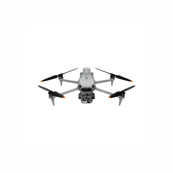
A fast-deploy platform can support routine calls, search missions, fire reconnaissance and mobile incident teams.
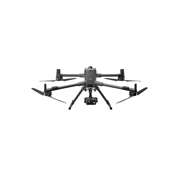
Larger platforms can support advanced thermal and zoom payloads, lighting, audio and specialized integrations for demanding missions.
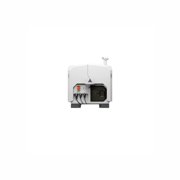
Dock-based systems can reduce launch delay and support repeatable remote operations when approvals, infrastructure and command integration are in place.
The table below is a starting point. The right system depends on the incident objective, required sensor, response time, environment, command structure, data policy and operating authorization.
| Operational Question | Typical Deliverable | Technology Path | Key Planning Limits |
|---|---|---|---|
| What is happening across the scene right now? | Live overhead video, annotated location or shared command view | Portable visual and thermal multi-sensor aircraft | Video quality, link reliability, airspace, pilot workload and information-sharing controls affect usefulness. |
| Where are heat signatures or hotspots? | Thermal view, temperature-screening image or hotspot coordinate | Radiometric thermal camera with visual context | Thermal does not see through walls; smoke, glass, water, distance, angle and emissivity affect interpretation. |
| Where should search teams concentrate? | Search-sector record, possible-target location or route guidance | Thermal, optical zoom, spotlight and mapping tools | Vegetation, terrain, weather, target temperature and false positives require ground confirmation. |
| How can command assess a hazardous scene from stand-off? | Live visual/thermal overwatch and changing-condition record | Weather-resistant platform with high zoom and thermal payload | The drone may identify patterns but cannot replace atmospheric monitoring, technical entry teams or specialist sensors. |
| What changed after a disaster or major incident? | Orthomosaic, 3D model, route-status map or damage record | RGB mapping, RTK and compatible processing software | Rapid products may prioritize speed over survey accuracy; coordinate control and validation must match the intended use. |
| Can aerial response begin before field crews arrive? | Remote live feed, dispatch-linked flight and searchable task record | DJI Dock 3, Matrice 4TD and FlightHub 2 or compatible DFR software | Site coverage, network, weather, detect-and-avoid, BVLOS authority, staffing and data integration determine feasibility. |
Each tool answers a different question. More sensors do not automatically create a better response; the information must reach the right decision-maker in a form they can use.
Shows apparent surface-temperature patterns and can support hotspot screening, search, exposure monitoring and selected hazardous-scene observations. It does not see through walls and requires trained interpretation.
Helps operators inspect distant details, observe movement and maintain separation from hazards. Atmospheric conditions, vibration, lighting and digital zoom can reduce usable detail.
Can help place a target or hazard on a shared map and communicate distance or position. The coordinate should be treated according to its measured accuracy and operational purpose.
Transforms overlapping imagery into maps or models for damage assessment, collision scenes, route planning and recovery documentation. Processing time and accuracy depend on collection design.
Lighting and audio payloads can support night search, scene illumination, instructions or warnings. Use must be governed by mission policy, public communication procedures and aircraft capacity.
A pre-positioned dock can launch a remote aircraft in response to an alert. Canadian organizations such as CERRA have helped advance evaluation and knowledge sharing around DFR and responder robotics; operational deployment still depends on local approvals and governance.
This official DJI introduction shows how Dock 3 supports fixed and mobile remote operations. A public-safety deployment still requires a complete concept of operations, Canadian authorization, site design, network planning and command integration.
A dependable program begins with the incident workflow, operating authority, people and information requirements—not a model number.
Public-safety operations may be urgent, but they still require a defined aviation, command and data-governance framework. The correct pathway depends on aircraft weight, airspace, proximity to people, operating range and the agency’s concept of operations.
Build approvals, airspace coordination, pilot qualifications, documentation and escalation procedures before the call arrives. An emergency scene is the wrong place to discover a gap in the operating concept.
Transport Canada recognizes Basic, Advanced and Level 1 Complex pathways. The aircraft, location, distance from people and operating concept determine which certificate, declaration, operator certificate or special permission may apply.
Review Transport Canada operation categoriesDock-based or beyond-visual-line-of-sight response requires a compliant operational pathway, trained personnel and an approved concept of operations. Depending on the mission, Level 1 Complex rules or an SFOC-RPAS may be required.
Review special-operation guidanceCoordinate with incident command, air operations and air traffic services as required. Unauthorized drone flights near wildfires or active emergency aircraft can endanger crews and interrupt response operations.
Review wildfire RPAS safety guidanceDefine when recording is permitted, who can view or export data, how evidence is preserved, how long files are retained and whether cloud, on-premises or third-party integrations meet agency requirements.
Important: Regulatory and policy information changes over time and should not be treated as legal advice. Confirm current Transport Canada, NAV CANADA, provincial, municipal, agency, privacy, evidence and incident-site requirements for each operation.
A pilot project should test the full operational chain—from dispatch and launch to command use, data handling, maintenance and after-action review.
Select priority incident types, response objectives, governance, authority and measurable success criteria.
Test representative scenarios with controlled exercises, realistic communications and documented constraints.
Confirm sensor performance, response time, command usefulness, airspace procedures and data handling.
Create SOPs, training, checklists, maintenance, evidence procedures, escalation rules and recurrent exercises.
Expand aircraft, pilots, launch sites or docks only after readiness, support and operational value are proven.
These are neutral starting points for consultation. The right configuration depends on response time, sensor reach, weather, operating range, payloads, data workflow and Canadian authorization.
Platform note: The largest aircraft is not automatically the best public-safety aircraft. Launch speed, sensor fit, weather resistance, command integration, transport, staffing, maintenance and readiness often matter more than headline specifications.
For rapid deployment, thermal search support, fire reconnaissance, scene awareness and routine public-safety missions from a compact mobile kit.
For demanding thermal, optical-zoom, long-duration and multi-payload operations, with optional spotlight, speaker and ecosystem integrations.
For pre-positioned fixed or mobile remote response, centralized live video and repeatable DFR workflows through FlightHub 2 or compatible software.
| System Path | Public Safety Role | Strengths | Planning Notes |
|---|---|---|---|
| DJI Matrice 4T | Rapid response, thermal search, fire and scene awareness | Compact integrated visual, zoom, thermal, rangefinding and low-light platform | Confirm lighting accessories, battery rotation, weather limits, data policy and mission-specific stand-off. |
| DJI Matrice 400 + Zenmuse H30T | Advanced incident command, extended overwatch and demanding thermal/zoom missions | Longer-endurance multi-payload platform with high-reach visual and thermal sensing | Requires larger transport, battery infrastructure, trained crews, payload planning and lifecycle support. |
| DJI Dock 3 + Matrice 4TD | DFR, fixed-site readiness, remote patrol and alert-driven aerial response | Remote launch, charging, weather protection and integration with FlightHub 2 | Requires site design, reliable power/network, coverage analysis, BVLOS authority, remote staffing and contingency procedures. |
| DJI Matrice 30T | Existing portable public-safety fleets and integrated thermal response | Weather-resistant, field-proven all-in-one multi-sensor aircraft | Still useful in established programs; compare lifecycle, support and sensor requirements against newer pathways. |
| DJI Matrice 350 RTK + H20T/H30T | Existing modular enterprise fleets and specialized payload missions | Hot-swappable dual-battery workflow and broad payload compatibility | Payload compatibility, procurement timing and desired sensor generation should be confirmed. |
| DJI FlightHub 2, Speakers, Spotlights & Care Plans | Command collaboration, fleet management, remote operations and lifecycle support | Connects aircraft activity to live video, task records, remote control and support workflows | Licensing, integrations, user roles, cybersecurity, data hosting and maintenance should be planned with the aircraft. |
Tell us which incidents your team needs to support, how quickly aerial intelligence is required and who must receive it. We’ll help translate that requirement into a practical aircraft, sensor, software, training, compliance and lifecycle plan.
Common questions from fire, police, search-and-rescue, emergency-management and public-sector teams evaluating drone technology.
Thermal cameras measure apparent surface-temperature patterns. They do not see through walls, and dense smoke, glass, water, distance, angle and material properties can affect the image. Thermal information should be interpreted with scene context and ground intelligence.
DFR is an operating model in which a drone is dispatched quickly—often from a pre-positioned location or dock—to provide aerial awareness before or alongside ground responders. It is a program architecture involving dispatch, remote operations, airspace, approvals, software, data and staffing, not just a drone product.
Compatible systems can connect alerts or dispatch data to remote-flight workflows, but the permitted level of automation and human authorization depends on the agency’s concept of operations, software, Canadian approvals, airspace and risk controls.
Matrice 4T is the more portable rapid-response option. Matrice 400 with H30T is better suited to higher-endurance, longer-reach and multi-payload missions. The right choice depends on launch time, observation distance, weather, transport, payloads, staffing and budget.
Yes. Established fleets can remain highly useful when they meet the mission and are supported by batteries, maintenance, trained pilots and current firmware. A lifecycle review can determine whether to retain, expand or transition the fleet.
Typical areas include mission authority, pilot qualifications, airspace checks, crew roles, launch criteria, coordination with crewed aircraft, lost-link and emergency actions, privacy, evidence, data retention, maintenance, battery management, reporting and recurrent training.
Yes. A complete engagement can include requirement discovery, product configuration, demonstrations, pilot deployment, training, compliance planning, software and data workflow design, maintenance and phased scaling.
